I am told there are people who do not care for maps, and I find it hard to believe. The names, the shapes of the woodlands, the courses of the roads and rivers, the prehistoric footsteps of man still distinctly traceable up hill and down dale, the mills and the ruins, the ponds and the ferries, perhaps the Standing Stone of the Druidic Circle on the heath; here is an inexhaustible fund of interest for any man with eyes to see, or tuppenceworth of imagination to understand with. No child but must remember laying his head in the grass, staring into the infinitesimal forest, and seeing it grow populous with fairy armies. Somewhat in this way, as I pored upon my map of Treasure Island, the future characters of the book began to appear there visibly among imaginary woods; and their brown faces and bright weapons peeped out upon me from unexpected quarters, as they passed to and fro, fighting and hunting treasure, on these few square inches of a flat projection.
Robert Louis Stevenson, Treasure Island
Passage quoted in Katherine Harmon, You Are Here. Personal Geographies and Other Maps of the Imagination.
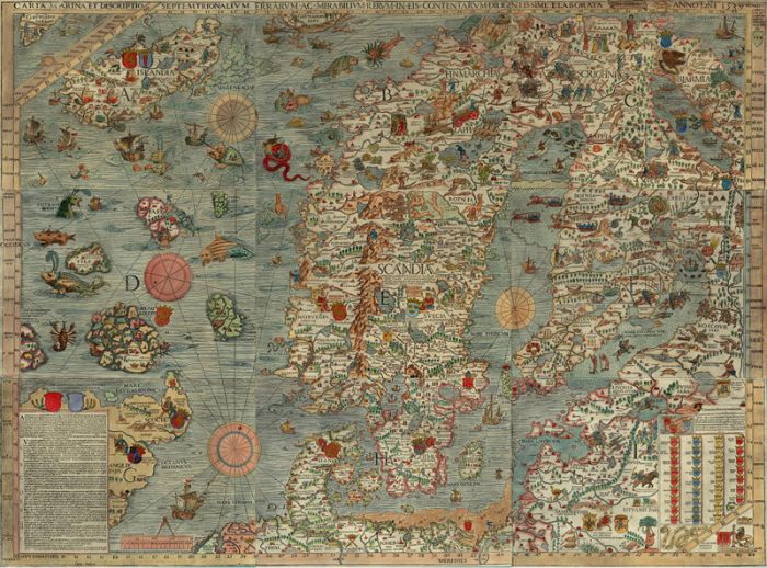
I saw a copy of Olaus Magnus’s Carta Marina at the University Library in Uppsala last November and thought it so fascinating that I bought a black-and-white poster of it (which still awaits being put up somewhere, shamefully). First published in 1539, it is one of the earliest maps of the Scandinavian countries and the Baltic coast line, and while it is largely visionary and imaginary, scientists recently discovered that its depictions of sea swirls and currents are surprisingly accurate. For a closer view of the fabulous sea monsters and details such as amber collectors (section H) or seal hunters (section C), click on the digitalised version here.

Pingback: The Insatiable and Gluttonous Wolverine « Mapping the Marvellous